Albright Institute Brings Trends in Digital Archaeology to the Fore
FEBRUARY 16th, 2016
By Sarah Fairman
“I think any of you could go home today and do this.”
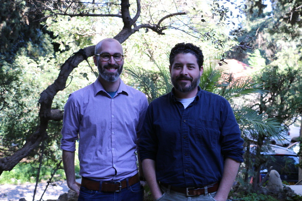
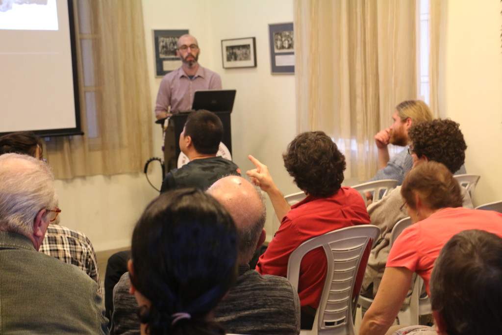
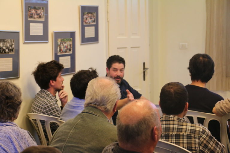
So Adam Prins challenged those present at his seminar last week, “3D Models in Archaeological Excavation Recording: The JVRP Method.” After his elegant and accessible explanation, the participants seemed to agree. The seminar was the inaugural event in what Director Matthew Adams envisions as an ongoing series devoted to digital archaeology and current trends in that field.
Excavation unit at Legio from 3D model
Prins emphasized the accessibility of the technology known as “structure from motion” already being used by several archaeological projects around the world. His focus was the specific methodology developed by the Jezreel Valley Regional Project (JVRP), which produces millimeter-accurate photo-realistic 3D models for each locus/context, nimbly and ingeniously replacing traditional analog documentation. There were palpable murmurs of awe from the crowd when Prins demonstrated the process of turning photographs into an interactive 3D model. Prins explained that the methodology “applies to anything on any scale,” including artifacts. One could make models of sherds, for example, and use the program to “cut” them right down the middle to get the shape and other identifying characteristics.
Prins is currently finishing up his PhD at Durham University in the Archaeology and Geography departments focusing on the applications and development of Lidar and other 3D technologies for archaeology in the Jezreel Valley.
There are clear benefits to using this methodology instead of traditional drawing. Prins illustrated this with a side-by-side comparison of a 3D rendering of a wall with one produced by an artist. “Drawing is subjective, whereas 3D models are objective; we often draw something how we want to see it,” said Prins. These alterations are made unconsciously, but do compromise accuracy; the brain predicts how a wall is supposed to look, perhaps manifesting in an idealized version.
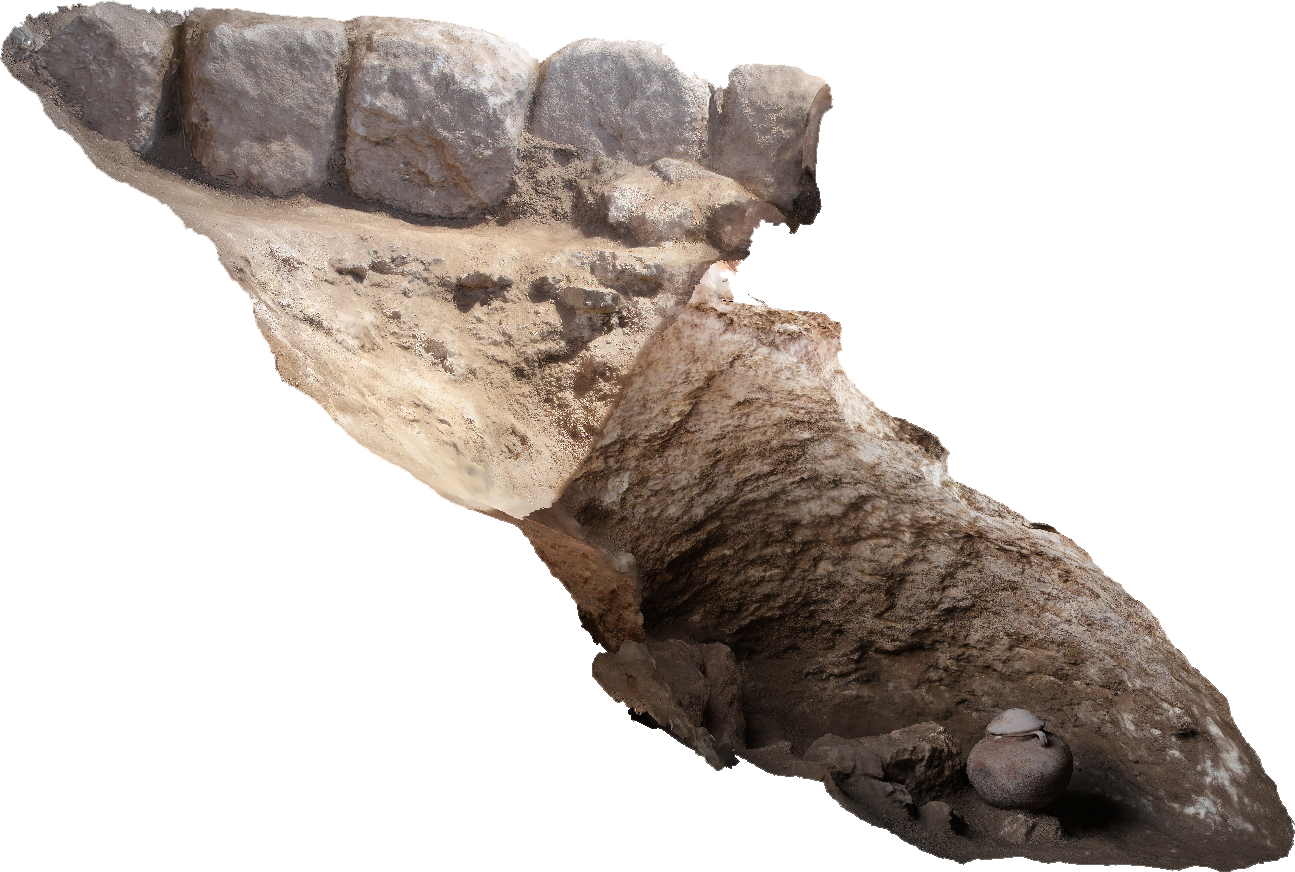
Cave at Legio in profile, from 3D model. Inherently a difficult archaeological form to record.
Photogrammetry avoids these issues by virtue of the camera’s relative objectivity. It also allows for views, angles and layouts that one would never otherwise be able to record in a visually coherent way. Prins showed us a 3D model of a cave to illustrate the ease with which this methodology ameliorated this problem; a cave is a form that is inherently difficult to record. Furthermore, creating a model at each stage of excavation shows the process, and exactly how the archaeologist chose to excavate the site. Integration with other excavation data is seamless. Information can be shared easily; one can produce files of about 10MB in size and send to anyone for a quick opinion, or at-a-glance consultation. Applications to other emergent technologies are self-evident. The didactic and research possibilities are endless. One archaeologist in attendance, long-since retired from field work, praised the methodology while lamenting “I am very sad at the same time, as I see what could have been done.”
Only a few tools are needed: a digital camera, total station or GPS (important for producing spatially-aware images), color scale, photogrammetry targets (for scale and automatic georectifying), Agisoft Photoscan Pro, and a decent computer. Costs are relatively low.
People had questions. “Why are there no scale rulers?” (Automatic georectifying eliminates need for scale rulers in photographs). “What about the shadows from the tents?” (Early morning is best time to photograph. Indeed, shadows can be a problem, but the software and an Adobe Lightroom workflow evens out problematic parts of the images). “Can you use the models for 3D printing?” (Yes!) The exciting possibilities seem to outweigh the concern. Any technology has issues, but also many smart people to work on fixing them! Already a “convinced believer” in photogrammetry, Dr. Ignacio Arce, who attended the seminar, praised the “open-source, user-friendly approach.”
It is clear that the methodology has a big-picture benefit as well. “As archaeologists we are increasingly aware of the destructive nature and fragility of our fieldwork. Attempts to mitigate these challenges must come in the form of methodological innovation,” said Prins. “Structure from motion”-based methods are especially prescient in a time of great uncertainty in the archaeologically loaded swaths of land in the Middle East, where sites are either destroyed, threatened, or inaccessible. The more people that use the method–thereby adding georectified data–the healthier and more robust the database will become; thus the more we protect our cultural heritage (see: Million Image Database).
Cave at Legio in profile, from 3D model. Inherently a difficult archaeological form to record.
Prins will be publishing a step-by-step method in the JVRP’s White Papers in Archaeological Technology online series in the coming weeks. Director Adams is a proponent of access to information for the sake of progress: “There are many archaeological projects out there developing similar methods. We believe that freely sharing the ‘how-to’ methods we develop can help others, and we hope that other projects will do the same so that we can all benefit from advances in archaeological method.”
In the same vein, Director Adams is pushing the Albright’s events as a viable teaching opportunity. “There’s much value in the workshops and lectures as instructional and interactive, and not merely a presentation or summary of what one is researching. The exchange of information is important, especially in a project like this, where the more people that adopt and use it, the more there are benefits for the entire enterprise. We’re happy to be among those doing the latest cutting-edge things so that we can all share this information and improve together.”
Director Adams is looking ahead; he hopes in the not-too-far future to establish a digital archaeology laboratory at the Albright.
Contact & Newsletter
We welcome visitors by appointment, Sunday through Thursday.
To visit the library, please contact the head librarian 24 business hours in advance of your visit library@aiar.org
For other visits, please book an appointment 24 business hours in advance by contacting albrightinstitute@aiar.org
We welcome you to join our public lectures. Subscribe to our newsletter & follow us on Facebook and Instagram to stay up to date with our news, events, and programming.
If you’re interested in hosting an event, dinner, reception, group tour or meeting at the Albright, please contact us at albrightinstitute@aiar.org for options.
In Jerusalem:
Street Address: 26 Salah ed-Din Street, 9711049 Jerusalem
Postal Address: P.O. Box 19096, 9119002 Jerusalem
Telephone: +972(0)2-628-8956
Fax: +972(0)2-626-4424
Email: albrightinstitute@aiar.org
US Business Office:
Angie Quinn, US Finance Manager, 6031 26th Street, North; Arlington, VA 22207
Telephone.: (703) 606-5682
Email: angiequinn@aiar.org